


Montana Wind Maps
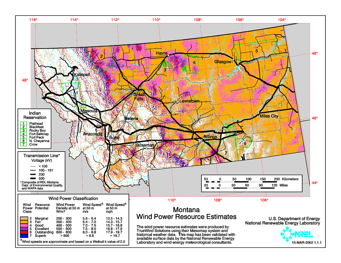 This map of Montana shows the wind resource at 50 meters. You can view a larger version or download a printable map [PDF/6.6MB] Download Adobe Reader.
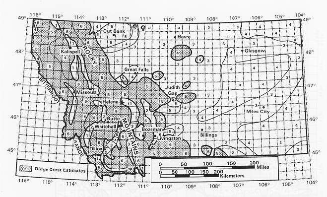
The wind in the United States could produce more than 4.4 trillion kWh of electricity each year-more than one and one-half times the 2.7 trillion kWh of electricity consumed in the United States in 1990. The Montana maps below show annual average wind resources using the 7 wind power classes, which are ranges used to describe the energy contained in the wind. Note the "Outstanding" classification (red) for wind resources on the Blackfeet Indian Reservation in northwest Montana.
Courtesy The National Renewable Energy Lab.
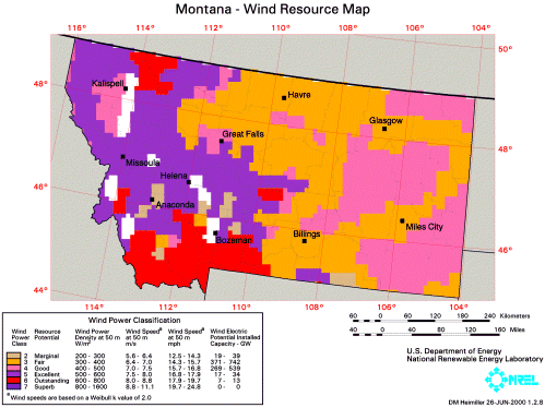
The map below is from the Wind Energy Resource Atlas of the United States, published online by the Renewable Resource Data Center (RReDC). The RReDC is supported by the National Center for Photovoltaics (NCPV) and managed by the Department of Energy's Office of Energy Efficiency and Renewable Energy. The RReDC is maintained by the Distributed Energy Resources Center of the National Renewable Energy Laboratory.
More data is available from the Department of Environmental Quality's Montana Wind Power Map.
More Information
Established in 1985, the Montana Natural Resource Information System (NRIS) was designed to simplify the task of identifying and acquiring natural resource information. As a program of the Montana State Library, NRIS makes information on Montana's natural resources easily and readily accessible. NRIS also operates a clearinghouse and referral service.